
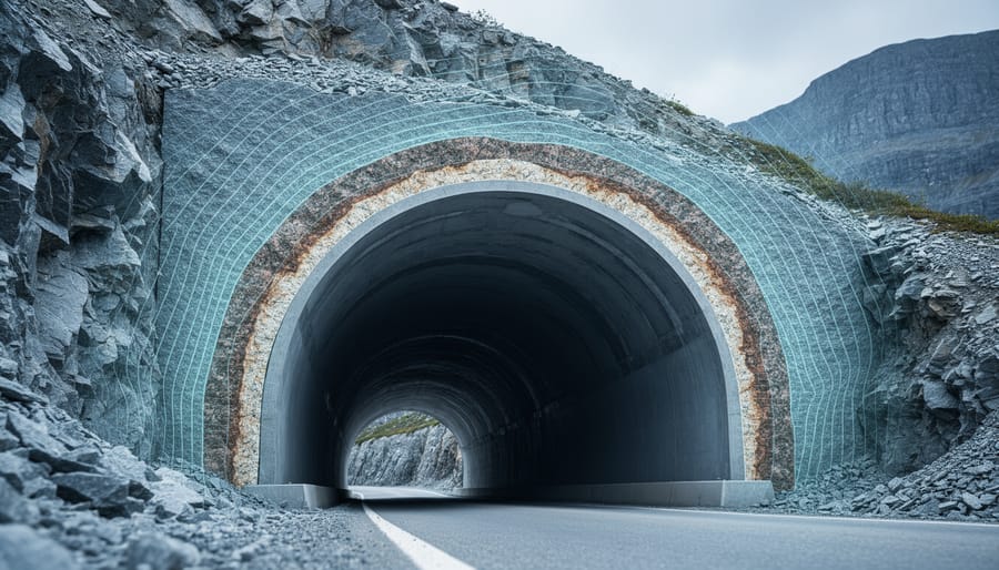

Seismic activity is the occurrence of ground movement caused by the sudden release of energy in the Earth’s crust, most commonly recognized through earthquakes, tremors, and volcanic vibrations. These underground forces shape landscapes, influence infrastructure design, and remind us that the ground beneath our feet is part of a dynamic, living planet.
For anyone living in Canada, seismic activity isn’t just an abstract geological concept. It’s a real consideration for tunnel engineers working beneath Vancouver’s bedrock, for architects designing resilient buildings along the Cascadia Subduction Zone, and for communities monitoring the occasional tremors that ripple through regions we often think of as stable. Across the country, from British Columbia’s active fault lines to the ancient shield rock of the Canadian Precambrian, ground movement tells the story of tectonic forces at work.
This article breaks down what seismic activity actually means in plain language. You’ll learn how these underground movements happen, the different types that scientists track, and the practical ways this knowledge supports everything from safe tunnel construction to renewable energy development. Whether you’re a student tackling earth science, a professional in green infrastructure, or simply curious about the forces shaping Canadian landscapes, understanding seismic activity opens a window into one of nature’s most powerful processes.
The good news? Seismic monitoring has never been more accessible. Open data initiatives let anyone explore real-time earthquake information, and advances in measurement techniques help communities build safer, more sustainable spaces underground. Far from being cause for alarm, understanding seismic activity equips us to work smarter with the Earth’s natural rhythms.
What Seismic Activity Means
Seismic activity refers to the movement and release of energy within the Earth’s crust, caused by the sudden shifting of rock masses or the propagation of vibrations through underground layers. When stress builds up along geological faults or within rock formations, it eventually exceeds the strength of the material holding it in place. That stored energy releases rapidly, sending waves of motion through the ground that we experience as earthquakes or tremors.
Not all seismic activity stems from natural tectonic processes. While most events result from the slow dance of Earth’s crustal plates grinding against each other, human activities can also trigger seismic movement. Mining operations, reservoir impoundment behind large dams, geothermal energy extraction, and underground fluid injection have all been linked to induced seismicity. These human-caused events typically produce smaller magnitudes than major tectonic earthquakes, but they still matter for communities and infrastructure planning, particularly in regions where underground development is expanding.
Understanding seismic activity requires familiarity with a few core terms that scientists and monitoring agencies use to describe these events:
- Seismic waves
- The pulses of energy that travel through the Earth following a stress release, including fast-moving primary waves and slower secondary waves that shake the ground in different directions.
- Epicenter
- The point on the Earth’s surface directly above where the seismic energy originated underground.
- Hypocenter
- The actual underground location where the rock rupture begins and energy is first released, also called the focus or focal point.
- Magnitude
- A numerical measure of the total energy released by a seismic event, typically expressed on scales like the moment magnitude scale that replaced the older Richter scale.
- Intensity
- A description of the shaking’s effects at a particular location on the surface, which varies with distance from the epicenter and local ground conditions.
These concepts form the foundation for how we detect, measure, and communicate about seismic events across Canada’s diverse geological landscape.
How Seismic Activity Works
The Role of Tectonic Forces
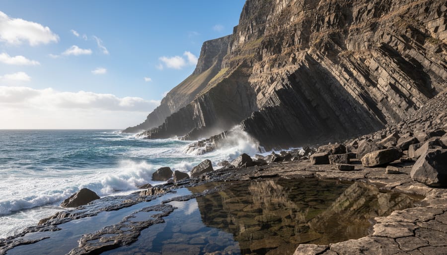
Canada sits near the edge of the North American Plate, where tectonic forces quietly build stress deep underground. While the country’s interior rests on stable continental crust, its western coast tells a different story. There, the Juan de Fuca Plate slides beneath the North American Plate along the Cascadia Subduction Zone, a 1,000-kilometer fault stretching from northern Vancouver Island to northern California. This collision zone has produced magnitude 9 earthquakes in the past and continues to accumulate strain today.
Plate boundaries aren’t the only culprits. Even far from the coast, ancient faults within the North American Plate can slip under stress, generating earthquakes in places like the St. Lawrence River valley. These intraplate faults formed millions of years ago but remain weak points in the crust where pressure concentrates.
Whether at a subduction zone or an inland fault, the mechanism is similar: tectonic plates move millimeters per year, rock bends under the strain, and eventually something breaks. The sudden slip releases energy as seismic waves, shaking the ground above. Understanding where these forces concentrate helps engineers design safer tunnels, geothermal systems, and underground infrastructure across Canada’s varied geology.
Energy Release and Wave Propagation
When rock along a fault finally breaks under accumulated stress, the stored energy radiates outward as seismic waves, much like ripples spreading across a pond. The release doesn’t happen in one simple burst. Instead, three distinct wave types travel through and around the Earth, each moving at different speeds and causing different ground motion.
Primary waves, or P-waves, arrive first. They’re compression waves that push and pull rock particles in the same direction the wave travels, moving through solid rock, loose soil, and even water. These waves travel fastest, which is why monitoring stations detect them before other wave types and why they provide the first warning of an earthquake. Secondary waves, or S-waves, follow behind, shearing rock side to side as they pass. They move only through solid material, not liquids, so they reveal information about the Earth’s internal structure when they stop at certain boundaries.
Surface waves arrive last but often cause the most damage. They travel along the Earth’s surface rather than through its interior, producing the rolling motion and side-to-side shaking people feel during earthquakes. All three wave types behave differently as they encounter various underground materials. Dense bedrock transmits waves efficiently with less shaking, while soft sediments amplify ground motion significantly, sometimes turning moderate shaking into severe movement that damages buildings and infrastructure above.
Types of Seismic Activity
Seismic activity comes in several distinct forms, each with its own causes and characteristics. Understanding these categories helps us make sense of the varied seismic events recorded across Canada, from subtle tremors beneath urban centers to powerful earthquakes along the west coast.
- Tectonic earthquakes, result from stress release along faults and plate boundaries, the most common type in Canada
- Volcanic seismicity, tremors and quakes associated with magma movement and volcanic processes
- Induced seismicity, human-caused events triggered by activities like mining, reservoir filling, or resource extraction
- Microseismic events, tiny tremors often too small to feel but detectable by sensitive instruments
- Significant events, larger quakes that affect communities, tracked on Earthquakes Canada’s Significant Events page
Tectonic earthquakes dominate Canada’s seismic landscape. These events occur when accumulated stress along geological faults exceeds the strength of surrounding rock, causing sudden movement. The Cascadia Subduction Zone off British Columbia’s coast generates the country’s most powerful tectonic events, while smaller faults scattered across Eastern Canada produce frequent but generally milder quakes. Vancouver seismic activity exemplifies how tectonic processes shape urban planning and infrastructure decisions in high-risk areas.
Volcanic seismicity occurs in regions with active or dormant volcanic systems. While less common than tectonic events in most of Canada, volcanic tremors can signal changes in underground magma chambers or geothermal systems. These swarms of small earthquakes often precede volcanic activity and provide valuable warning signs for monitoring networks.
Induced seismicity has gained attention as human activities increasingly influence underground stress patterns. Mining operations, particularly in Ontario and Quebec, can trigger localized tremors as rock masses adjust to new voids. Reservoir-induced seismicity sometimes follows the filling of large hydroelectric dams, while injection of fluids during resource extraction can also generate small earthquakes. Understanding induced events helps engineers design safer underground projects and informs regulatory frameworks.
Microseismic activity represents the constant low-level movement within the Earth’s crust. These tiny events rarely register on standard seismographs but play a crucial role in research, helping scientists map underground structures and track stress changes over time. For geothermal developers and tunnel builders, microseismic monitoring provides real-time feedback about how underground environments respond to development activities.
How We Measure Seismic Activity
Seismographs and Monitoring Networks
Seismographs are sensitive instruments that detect and record ground movement, converting physical motion into readable data. Modern digital seismographs use electronic sensors that measure ground displacement in three dimensions: vertical, north-south, and east-west. When seismic waves pass through, these sensors generate electrical signals that computers process into seismograms, the wavy line recordings that scientists analyze to determine an earthquake’s location, depth, and magnitude.
Canada operates an extensive network of monitoring stations strategically positioned across the country to capture seismic activity in real time. This network includes permanent seismograph stations in both high-risk zones like coastal British Columbia and lower-activity regions across the Prairies and eastern provinces. The stations continuously transmit data to central processing centres, enabling rapid detection and analysis of earthquakes as small as magnitude 2.5 in populated areas.
The network’s coverage ensures that when seismic events occur, multiple stations record the shaking from different angles. By comparing arrival times of seismic waves at various stations, scientists triangulate the earthquake’s origin point. This distributed monitoring system also supports open data initiatives, making seismic information freely available to researchers, engineers, and the public for analysis and education.
Magnitude Scales and Uncertainty
When an earthquake occurs, scientists assign it a magnitude value to communicate its size, but no measurement is perfectly precise. The Richter scaledeveloped in the 1930s, was the first widely-used system for quantifying earthquake strength. It measures the amplitude of seismic waves on a logarithmic scale, meaning a magnitude 5 earthquake releases about 32 times more energy than a magnitude 4. While the Richter scale remains culturally familiar, most seismologists today use the moment magnitude scale (Mw), which better captures the total energy released, especially for large or distant earthquakes.
Both scales provide a single number, but that number comes with inherent uncertainty. Seismometers at different stations may record slightly different readings, and the calculations involve estimates of depth, distance, and rock properties. For basic magnitude values, uncertainty is typically small, around ±0.1 to ±0.3 units. More specialized measurements, like earthquake focal mechanism data that describe fault orientation and slip direction, often rely on simplified error metrics such as a single standard error angle or a qualitative rating rather than full uncertainty ranges. These simplifications make the data easier to interpret, though they don’t capture every source of variability in complex geological systems.
Where to Find Canadian Seismic Activity Data
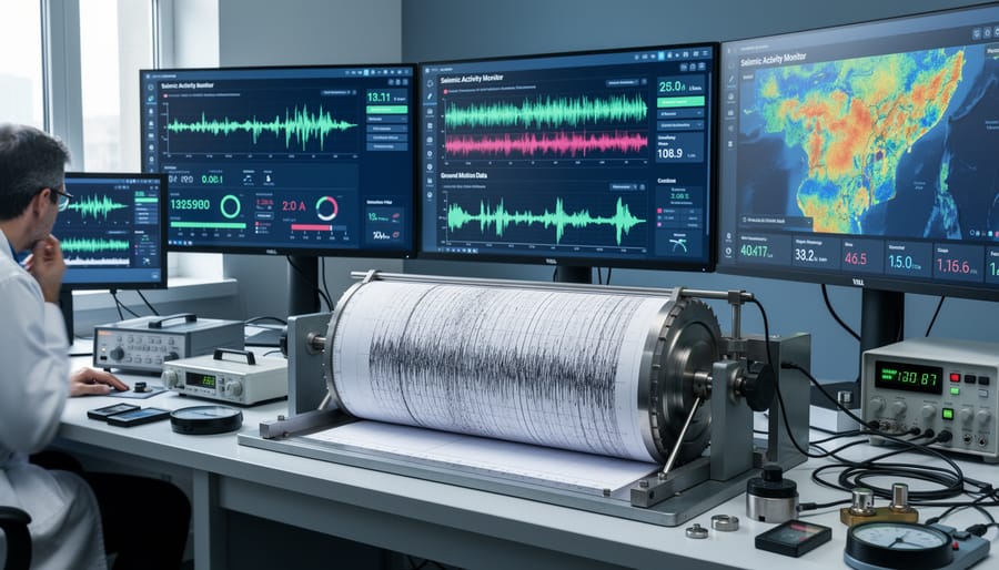
Curious about seismic events in your region? Canada maintains one of the world’s most accessible earthquake monitoring systems, and the data is free for anyone to explore.
Earthquakes Canada data serves as the primary resource for anyone wanting to understand seismic activity across the country. Natural Resources Canada operates this comprehensive platform, which publishes real-time information on detected earthquakes. The Significant Events page highlights notable seismic activity and provides context for what these events mean for communities and infrastructure.
You’ll find detailed maps showing where tremors occur, along with magnitude readings, depth measurements, and time stamps. The interface allows you to filter events by date range, magnitude, or geographic region, making it straightforward to focus on your area of interest. Each recorded event includes technical details that help scientists track fault networks and understand how energy moves through different geological formations.
This open data approach means researchers, engineers, students, and concerned citizens can access the same information that government scientists use. Open data, by definition, is structured information that’s machine-readable and freely shared without restrictions. For underground development projects in Canada, this accessibility proves invaluable. Tunneling engineers can review historical patterns before breaking ground, while geothermal energy developers can assess subsurface conditions in proposed project areas.
The transparency builds public trust and enables community engagement with scientific findings. You don’t need specialized training to explore the basics, though the platform also accommodates technical users who need raw data for research or risk assessment models.
How Seismic Activity Information Is Used
Understanding seismic activity isn’t just an academic exercise. The knowledge we gain from monitoring ground movement directly shapes how we build, plan, and protect communities across Canada. From designing safer infrastructure to advancing renewable energy projects, seismic information serves as a foundation for practical decisions that affect millions of people.
Engineers and architects rely on seismic data when planning any significant underground project. Before breaking ground on a subway tunnel in Vancouver or a geothermal system in Alberta, developers analyze historical seismic patterns to understand the forces their structures might face. This information helps them choose appropriate construction materials, determine optimal depths, and design reinforcement systems that can withstand ground movement. The goal isn’t to prevent earthquakes, that’s impossible, but to build infrastructure that remains functional and safe when they occur.
Seismic activity information supports several critical applications across Canada:
- Designing earthquake-resistant tunnels, transit systems, and underground storage facilities that can flex with ground movement
- Planning geothermal energy projects by identifying suitable geological conditions and potential seismic risks
- Assessing environmental impacts of resource extraction and construction activities on surrounding communities
- Informing emergency preparedness plans with realistic scenarios based on regional seismic hazards
- Advancing green construction technologies that integrate seismic resilience with sustainability goals
Resource developers use seismic monitoring to track induced earthquakes, those caused by human activities like hydraulic fracturing or wastewater injection. In regions where these activities occur, continuous monitoring helps operators adjust their practices to minimize seismic risks, protecting both communities and the environment. This real-time feedback loop represents a responsible approach to resource development that balances economic needs with public safety.
Emergency planners and municipal governments consult seismic hazard maps when creating response protocols and building codes. A coastal British Columbia community faces different earthquake risks than a city in Ontario, and their preparedness strategies reflect those differences. Seismic data helps allocate resources effectively, ensuring that high-risk areas receive appropriate attention while avoiding unnecessary precautions in stable regions.
Perhaps most exciting is how seismic understanding enables Canada’s transition to sustainable energy. Geothermal projects tap into the Earth’s heat, but they require detailed knowledge of underground conditions to succeed. Seismic surveys reveal fracture networks and rock formations that can store and transmit heat efficiently, guiding developers toward the most promising sites for clean, renewable energy generation that could heat Canadian homes for generations.
Seismic Activity and Canada’s Underground Future
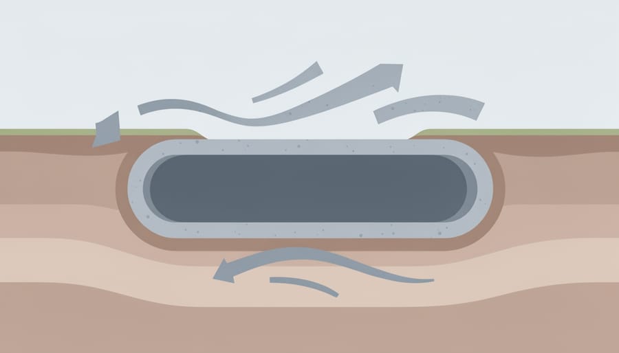
Understanding how the ground moves isn’t just about predicting earthquakes, it’s about building a smarter, greener future beneath our feet. As Canada looks to expand underground infrastructure for transportation, energy, and storage, seismic knowledge becomes a foundational tool for sustainable development.
Modern tunneling projects now integrate seismic data from the earliest planning stages. Engineers use ground motion models to select stable routes, design flexible support systems, and anticipate how different rock formations will behave under stress. The basics of tunneling already account for geological conditions, but adding seismic analysis means builders can work with the Earth’s natural rhythms rather than against them. This approach reduces construction risks, extends infrastructure lifespans, and minimizes environmental disruption.
Geothermal energy projects offer another compelling example. Drilling for heat requires detailed understanding of subsurface fractures and stress patterns, exactly the information seismologists gather. In regions with known seismic activity, developers can map natural fracture networks that enhance heat extraction while avoiding zones prone to induced seismicity. The result is cleaner energy with a smaller footprint and fewer surprises.
Underground transit systems, storage facilities for renewable energy, and carbon capture networks all benefit from the same principle: know the ground, build better. Canada’s diverse geology, from the stable Canadian Shield to the more active Pacific coast, demands site-specific solutions. Seismic monitoring networks provide the real-time feedback needed to adapt designs, refine construction methods, and maintain safety throughout a project’s lifetime.
This integration of seismic science and underground engineering represents practical optimism, using knowledge to expand possibilities while respecting natural systems.
Common Questions About Seismic Activity
Seismic activity raises natural questions for anyone living in or near geologically active zones. Understanding the basics helps communities make informed decisions about infrastructure, emergency preparedness, and sustainable development projects like those explored in SubterraPulse’s coverage of underground environments.
What causes seismic activity?
Seismic activity is caused by the movement of tectonic plates, volcanic processes, or human activities like mining and reservoir filling. In Canada, most natural seismic events occur where the Earth’s crust experiences stress from plate boundaries or ancient fault lines reactivating under pressure.
Can humans cause seismic activity?
Yes, human activities can trigger seismic events through processes like fluid injection, reservoir impoundment, mining, and geothermal energy extraction. These induced events are typically smaller than tectonic earthquakes, though understanding them is crucial for safe underground development.
How often does seismic activity occur in Canada?
Canada experiences thousands of seismic events annually, though most are too small to feel. Earthquakes Canada monitors and records these events through a national network, with significant events tracked on their dedicated page for public access.
What’s the difference between magnitude and intensity?
Magnitude measures the energy released at an earthquake’s source using instruments, while intensity describes the effects felt at specific locations. A single earthquake has one magnitude but varying intensities depending on distance from the epicenter and local ground conditions.
These questions reflect common concerns from communities exploring the benefits of going underground for transportation, storage, or energy projects. Accessing open seismic data, machine-readable, freely shared information without restrictions, empowers residents, researchers, and developers to assess geological conditions and design resilient infrastructure. When you understand how seismic monitoring works and what the measurements mean, you’re better equipped to engage with local planning decisions and appreciate the careful geological analysis that goes into sustainable underground development across Canada.
Understanding seismic activity isn’t just an academic exercise, it’s foundational knowledge for building safer, more resilient communities across Canada. As we develop underground infrastructure for transportation, harness geothermal energy, and plan sustainable cities, a solid grasp of how the Earth moves beneath us becomes essential. This knowledge helps engineers design earthquake-resistant tunnels, allows communities near active zones to prepare effectively, and enables better stewardship of our underground environments.
The beauty of seismic science today is its accessibility. Earthquakes Canada’s open data and monitoring networks mean that anyone, from students to professionals, can explore real seismic information and contribute to a culture of preparedness. When community engagement meets scientific literacy, we create stronger foundations for Canada’s underground future.
Whether you’re curious about the tremors beneath your feet or planning green technology projects, SubterraPulse offers resources to deepen your understanding of underground environments. Explore our articles on sustainable tunneling, geothermal development, and the intersection of geology with innovation, because the future we’re building starts below the surface.






+ There are no comments
Add yours