
Seismic activity refers to the frequency, type, and intensity of earthquakes occurring in a specific region, caused by the sudden release of energy in the Earth’s crust as tectonic plates shift, collide, or slide past one another. For Vancouver and British Columbia’s south coast, seismic activity is a geological reality. The region sits atop the Cascadia Subduction Zone, where the Juan de Fuca plate slowly dives beneath the North American plate, creating one of Canada’s most earthquake-prone areas.
Two recent earthquakes have brought this reality into sharper focus. On July 1, 2026, a magnitude 3.7 earthquake struck 57 kilometers east-southeast of Victoria at 11:35 p.m. PDT. Just under two weeks later, on July 14, a stronger magnitude 4.5 event occurred 201 kilometers west of Port Hardy at 3:58 a.m. PDT, according to Earthquakes Canada. While neither caused significant damage, these tremors remind us that living in southwestern British Columbia means coexisting with the forces shaping our landscape.
Understanding what these events mean requires looking beneath our feet. The underground processes driving Vancouver’s seismic activity connect directly to how we build resilient communities, design sustainable infrastructure, and prepare for the inevitable larger quakes scientists expect in this region. This isn’t about fear. It’s about informed readiness and recognizing that the same geological forces creating earthquake risk also shape the spectacular coastline, mountains, and geothermal potential that define British Columbia. By grasping the science behind recent tremors and taking practical preparedness steps, residents can turn geological awareness into community strength.
Understanding Vancouver Seismic Activity: A Plain-Language Definition
Vancouver seismic activity refers to the ground shaking and vibrations caused by movements of massive rock formations deep beneath southwestern British Columbia. When tectonic plates, enormous slabs of Earth’s crust, shift, collide, or slide past each other underground, they release energy that travels through the rock as waves, producing the earthquakes we feel at the surface.
In the Vancouver region, most seismic activity stems from the Cascadia Subduction Zone, an offshore fault system where the Juan de Fuca plate slowly dives beneath the North American plate. This ongoing collision, happening kilometers below the seafloor, builds up stress over decades and centuries. When that stress releases suddenly, it generates earthquakes. Smaller, shallower faults scattered across the region also produce frequent tremors, like the M3.7 event recorded 57 kilometers southeast of Victoria on July 1, 2026.
Understanding a few key terms helps make sense of earthquake reports:
- Magnitude
- A numerical measure of an earthquake’s size based on the energy released, typically reported on the moment magnitude scale (M). An M4.5 quake releases roughly 32 times more energy than an M3.5.
- Epicenter
- The point on Earth’s surface directly above where the earthquake rupture begins underground (the focus or hypocenter).
- Fault line
- A fracture in the Earth’s crust where blocks of rock move relative to each other, often the source of seismic activity.
- Subduction zone
- A region where one tectonic plate slides beneath another, creating powerful geological forces capable of producing large earthquakes.
- Seismic waves
- Energy waves that travel through rock and soil during an earthquake, causing the ground shaking we experience at the surface.
The recent M4.5 event 201 kilometers west of Port Hardy on July 14, 2026, demonstrates how this underground activity manifests across the region. These earthquakes aren’t random, they’re the visible expression of colossal geological processes reshaping our underground environment every day.
How Vancouver Seismic Activity Works
The Cascadia Subduction Zone: Our Underground Neighbor
About 100 kilometres off the coast of Vancouver Island, an enormous slab of ocean floor is quietly diving beneath British Columbia. The Juan de Fuca plate, a remnant of an ancient oceanic plate, slides eastward under the North American plate at roughly the speed your fingernails grow, about four centimetres per year. This process, known as Juan de Fuca subduction creates the Cascadia Subduction Zone, a 1,000-kilometre megathrust fault stretching from Northern California to central Vancouver Island.
As the denser oceanic plate grinds beneath the lighter continental crust, friction locks the two plates together. Stress accumulates over centuries while the edge of North America is slowly dragged downward and compressed. Eventually, when the accumulated strain exceeds the friction holding the plates in place, they suddenly snap back in a massive earthquake. Scientists estimate that the locked zone offshore has been storing energy since the last great Cascadia quake in 1700, which likely reached magnitude 9 and triggered a tsunami that struck Japan.
This underground neighbour is why Vancouver sits in one of Canada’s most seismically active zones. The megathrust fault doesn’t just threaten a single large event, it also drives the complex web of stresses that cause smaller earthquakes throughout southwestern British Columbia, from the crustal faults beneath the Strait of Georgia to the deep tremors scientists detect far below the surface. Understanding these Cascadia megathrust geohazards helps engineers design resilient infrastructure and communities prepare for the ground motion that’s an inevitable part of living above this dynamic underground environment.
Shallow Crustal Earthquakes and Local Faults
While the Cascadia Subduction Zone poses the region’s most dramatic long-term threat, most earthquakes that Vancouver-area residents actually feel come from a different source entirely: shallow crustal faults much closer to the surface. These faults cut through the upper layer of the North American plate, typically within the top 30 kilometres of Earth’s crust, and they release energy far more frequently than the offshore megathrust system.
The Shallow Victoria earthquake on July 1, 2026, a M3.7 event centred 57 km ESE of Victoria, offers a textbook example. Though its magnitude was modest, many residents reported noticeable shaking because the earthquake occurred relatively close to populated areas and near the surface, where seismic waves lose less energy before reaching communities above. These shallow crustal events happen when stress builds along local fault lines from the broader tectonic forces at work in the region, and they typically range from barely perceptible tremors to moderate shakes that rattle dishes and prompt quick bursts of social media activity. While they rarely cause serious damage, they serve as regular reminders that southwestern British Columbia sits atop a geologically active underground landscape, and that preparedness isn’t just about the big one, but about living confidently with the ground beneath our feet.
Types of Seismic Events in the Vancouver Region
Southwestern British Columbia experiences three distinct categories of earthquakes, each with its own underground origins and hazard profile. Understanding these types helps residents make sense of events like the M3.7 earthquake near Victoria on July 1, 2026, and the M4.5 event west of Port Hardy on July 14.
The first and most powerful category is megathrust earthquakes generated along the Cascadia Subduction Zone. These occur when accumulated stress between the subducting Juan de Fuca plate and the overriding North American plate releases suddenly. Megathrust events can reach magnitudes of 8.0 or greater and originate at depths of 10 to 30 kilometers offshore. While infrequent, the last major one struck in 1700, they pose the most significant seismic risk to the region.
Deep intraslab earthquakes form the second category. These happen within the Juan de Fuca plate itself as it descends beneath Vancouver Island and the mainland, typically at depths between 40 and 90 kilometers. Intraslab quakes commonly range from magnitude 4.0 to 7.0 and can be strongly felt at the surface despite their depth. The M4.5 event recorded 201 kilometers west of Port Hardy fits this pattern, occurring along the subducting slab far offshore.
Shallow crustal earthquakes represent the third type and the most frequent seismic activity residents experience:
- Megathrust events: magnitudes 8.0+, depths 10-30 km, occur once every few centuries
- Deep intraslab quakes: magnitudes 4.0-7.0, depths 40-90 km, happen several times per year
- Shallow crustal earthquakes: magnitudes 2.0-6.5, depths less than 30 km, occur dozens of times annually
The July 1 tremor near Victoria exemplifies this third category, a relatively modest M3.7 earthquake originating in the shallow crust beneath the southern Strait of Georgia. These crustal events result from compression and fracturing in the upper plate as the entire region responds to tectonic forces. Though smaller in magnitude, shallow quakes often feel stronger because their energy reaches the surface quickly with less attenuation through rock.
Each earthquake type leaves different signatures in the underground environment. Megathrust events release energy across hundreds of kilometers of fault surface, deep intraslab quakes produce sharp, focused shaking from a compact source zone, and crustal earthquakes generate localized ground motion. Engineers designing infrastructure, from SkyTrain tunnels to utility corridors, account for all three scenarios, ensuring Vancouver’s underground systems can withstand the range of seismic forces our active geology produces.
What Recent Seismic Activity Tells Us
The July 2026 Southwestern BC quakes offer a valuable snapshot of the ongoing tectonic forces shaping our region. On July 1 at 11:35 PM PDT, a magnitude 3.7 earthquake struck 57 kilometers east-southeast of Victoria, followed two weeks later by a stronger M4.5 event on July 14 at 3:58 AM PDT, located 201 kilometers west of Port Hardy. These two events, though separated by geography and magnitude, represent the kind of seismic activity that constantly releases stress along the complex network of faults beneath southwestern British Columbia.
The Victoria event likely originated from shallow crustal faulting, the type that occurs within the Earth’s upper crust as tectonic plates grind past one another. At magnitude 3.7, it would have been felt by many residents as a brief jolt or rumble but caused no damage, these quakes typically rattle windows and nerves more than structures. The Port Hardy quake, farther offshore and more than twice as energetic at M4.5, probably reflects deeper processes related to the subducting Juan de Fuca plate or the Explorer plate fragment to the north. Its remote location meant minimal impact on communities, but seismologists value such events because they illuminate the stress distribution across different parts of the Cascadia system.
What scientists learn from these earthquakes goes beyond pinpointing their exact locations. Each event adds a data point to long-term monitoring efforts, helping researchers understand how strain accumulates and releases over time. Patterns of smaller quakes can reveal previously unmapped faults, guide infrastructure planning, and improve the models that predict ground shaking during larger events. Rather than warning signs of an imminent megaquake, small earthquakes don’t reliably predict big ones, these events confirm that the underground environment beneath Vancouver and the broader region remains geologically active, a reminder to stay prepared and to keep investing in earthquake-resilient design for our tunnels, transit systems, and buildings.
How Seismic Monitoring and Data Are Used
Engineering Safer Underground Infrastructure
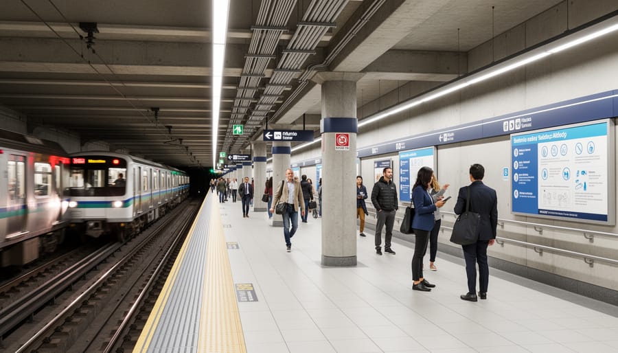
Vancouver’s seismically active underground environment shapes every major infrastructure project in the region. Engineers designing SkyTrain tunnels, utility corridors, and underground transit expansions rely on decades of seismic monitoring data to understand how different soil types amplify ground motion and where fault lines intersect planned routes. The Canada Line tunnel beneath downtown Vancouver, for example, incorporates flexible joints and reinforced concrete segments designed to withstand both moderate shaking and the lateral forces generated during an earthquake.
Seismic design standards for underground infrastructure in British Columbia go beyond simply preventing collapse. Engineers analyze historical earthquake patterns to predict peak ground acceleration, the maximum speed at which the ground moves during shaking, and design tunnels that can flex rather than fracture. This approach reduces long-term maintenance costs and ensures critical water, electricity, and transit systems remain operational after an event, supporting the region’s resilience and sustainability goals.
Future underground projects, including proposed utility corridors beneath False Creek and expanded transit networks, integrate lessons from recent seismic events. The M3.7 earthquake near Victoria and the M4.5 event west of Port Hardy provide real-world data that refine computer models, helping engineers anticipate how underground structures will respond in different geological conditions. This ongoing feedback loop between earthquake science and infrastructure design makes Vancouver’s underground spaces among the most earthquake-aware in Canada.
Community Early Warning and Response Systems
When an earthquake strikes, seconds matter. That’s where the ShakeAlert earthquake early warning system comes in, a network of seismic sensors across British Columbia and the Pacific Northwest that detects the first waves of an earthquake and sends alerts before stronger shaking arrives. While the warning time may be just a few seconds to a minute, that window is enough to drop, cover, and hold on, stop a train, or pause a delicate surgical procedure.
In southwestern British Columbia, Earthquakes Canada operates the monitoring stations that feed data into ShakeAlert. When sensors detect the initial, faster-traveling P-waves from an earthquake, algorithms calculate the likely magnitude and where the damaging S-waves will hit next. Alerts go out through wireless emergency systems, apps, and direct feeds to schools, hospitals, and transit operators, turning real-time seismic data into actionable protection.
Beyond technology, community preparedness programs amplify the impact of early warnings. Neighborhood earthquake drills, building retrofitting initiatives, and emergency response training ensure residents know what to do when an alert sounds. Emergency Management BC coordinates these efforts, helping communities develop evacuation routes, communication plans, and mutual aid networks. The goal isn’t just to react faster, it’s to build collective resilience so that when the ground shakes, Vancouver-area residents are ready, informed, and empowered to protect themselves and their neighbors.
Preparing Your Home and Community for Earthquakes

Living in Vancouver means sharing space with dynamic geological forces, but preparedness turns that reality into empowerment rather than anxiety. Start with the quick wins: secure tall bookcases, water heaters, and heavy mirrors to wall studs using earthquake straps or L-brackets. Move breakables to lower shelves, and store hazardous materials like cleaners in latched cabinets. These small fixes prevent most home injuries during shaking.
Every household needs an emergency kit stocked for at least 72 hours without services. Include water (four litres per person per day), non-perishable food, a battery-powered radio, flashlights, a first-aid kit, essential medications, copies of important documents in a waterproof pouch, and cash. Keep a smaller version in your car. Add a manual can opener, duct tape, a whistle, and sturdy shoes near your bed.
Create a family communication plan before the ground moves. Choose an out-of-province contact everyone can reach, since local phone lines often fail. Decide on two meeting spots: one just outside your home for minor events, another outside your neighbourhood if you’re separated. Practice Drop, Cover, and Hold On drills so the response becomes automatic, kids especially benefit from rehearsing calmly.
Older buildings constructed before modern seismic codes may need professional retrofitting: bolting the house to its foundation, bracing cripple walls, and reinforcing chimneys. Many municipalities offer rebate programs to offset costs. Understanding the basics of tunneling and how underground spaces in Canada are engineered reveals why similar seismic principles, like ensuring underground ventilation systems remain intact during shaking, apply to surface structures.
Extend preparedness beyond your doorstep. Join neighbourhood emergency response teams, participate in ShakeOut BC drills, and share supplies with elderly or mobility-limited neighbours. Collective resilience multiplies individual efforts. Recognizing benefits of going underground for critical infrastructure and understanding what underground spaces are used for helps communities advocate for earthquake-resistant design in transit, utilities, and public facilities.
Preparedness isn’t about fear; it’s about living confidently in a seismically active region by taking practical steps today.
Frequently Asked Questions About Vancouver Seismic Activity
Why does British Columbia have such significant earthquake risk? The province sits along the Cascadia Subduction Zone, where the Juan de Fuca plate slides beneath the North American plate, and is crossed by numerous shallow crustal faults. This geological setting makes southwestern BC one of Canada’s most seismically active regions, with hundreds of small earthquakes occurring each year and the potential for larger events.
Understanding the basics helps turn concern into confidence. The recent M3.7 earthquake near Victoria on July 1 and the M4.5 event west of Port Hardy on July 14 remind us that our underground environment is constantly adjusting, and being prepared means we can respond calmly and effectively when shaking occurs.
Are small earthquakes like the recent M3.7 a warning sign of a bigger one coming?
Not necessarily. Small earthquakes are normal in British Columbia and don’t reliably predict larger events. They release built-up stress in the crust, but scientists cannot use them to forecast when or where a major quake will strike.
How should Vancouver-area residents prepare for an earthquake?
Secure heavy furniture and water heaters, assemble an emergency kit with food, water, and supplies for 72 hours, and create a family communication plan. Practice Drop, Cover, and Hold On drills at home so everyone knows what to do when shaking starts.
What is the seismic hazard level in Canada?
Canada’s seismic hazard varies widely by region. Southwestern British Columbia faces the highest risk due to the Cascadia Subduction Zone and active crustal faults, while much of eastern Canada has lower hazard levels. Natural Resources Canada publishes detailed seismic hazard maps to guide building codes and infrastructure planning.
Why does the Vancouver region experience so many earthquakes compared to other Canadian cities?
Vancouver’s location above the Cascadia Subduction Zone and near multiple active fault lines creates frequent seismic activity. The ongoing collision between tectonic plates generates hundreds of small earthquakes annually, most too weak to feel but all part of the region’s dynamic geological character.
Earthquakes Canada monitors seismic activity 24/7 and provides real-time updates, so residents can stay informed without constant worry. The agency’s reporting of events like the recent July quakes gives scientists valuable data to refine hazard models and improve building standards. When communities understand the science and take practical steps, earthquake preparedness becomes a shared strength rather than an individual burden.
Participating in annual ShakeOut BC drills and staying connected with local emergency programs turns knowledge into action. Every secured bookshelf, every stocked emergency kit, and every practiced drill builds resilience across neighborhoods, making southwestern British Columbia safer for everyone who calls this geologically active region home.
Understanding Vancouver’s seismic activity isn’t about living in fear, it’s about living with knowledge. The recent earthquakes in southwestern British Columbia, including the M3.7 event near Victoria on July 1 and the M4.5 quake west of Port Hardy on July 14, remind us that we share this region with powerful geological forces constantly reshaping the ground beneath our feet. Rather than viewing this as a threat, we can see it as an opportunity to build smarter, prepare better, and create communities that thrive even in one of Canada’s most geologically active zones.
The underground environment that produces these earthquakes is the same environment we’re learning to work with through resilient infrastructure design, sustainable tunneling practices, and innovative monitoring systems. When we understand how the Cascadia Subduction Zone operates, how shallow crustal faults generate the tremors we feel, and what seismic data reveals about our region, we gain the tools to protect ourselves and our neighbors.
Take action today. Secure your space, build your emergency kit, and join a local earthquake drill. Stay connected with Earthquakes Canada for real-time updates and explore SubterraPulse resources to learn how Canada’s underground innovations are making our communities safer and more sustainable. Preparedness isn’t a burden, it’s how we turn geological reality into community strength. The ground beneath Vancouver will continue to move, and we’ll continue to adapt, innovate, and support each other through it all.